|

          
|
Kabul:-:
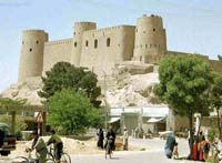
Kabul (käbool, kbool), capital and largest city of Afghanistan with population of over 1.5 million, is an economic and cultural center and strategically situated in a narrow valley along the Kabul River high in the mountains before the Khyber Pass. Kabul is linked with the Tajikistan border via a tunnel under the Hindu Kush Mountains. Its main products include ordnance, cloth, furniture, and beet sugar, though continual warfare since 1979 has limited the economic productivity of the city. Kabul remains one of the most mined cities in the world. The old section of Kabul is filled with bazaars nestled along its narrow, crooked streets. Kabul has a university, established in 1931, and a number of colleges. Cultural sites include a very good museum, Babur's tomb and gardens, the mausoleum of Nadir Shah, the Minar-i-Istiklal (column of independence) built in 1919 after the Third Afghan War, the tomb of Timur Shah, and some important mosques. Bala Hissar, a fort destroyed in retaliation for the death of their envoy by the British in 1879, was restored as a military college. Outside the city proper is a citadel and the royal palace. Kandahar:-:
Kandahar (or Qandahar) is a city in southern Afghanistan, capital of Kandahar province. The province has 567,000 people (based on 1979 data), while the city has around 200,000 (based on a 1989 estimate). It is the second largest city in Afghanistan and main trading centre, especially for agricultural produce. It has an international airport and extensive road links. Together with Peshawar, Kandahar is the main city of the Pushtu people. It is linked by road to Quetta in Pakistan. Mazar-i-Sharif:-:
Mazar-e Sharif, also known as Mazar-e-Sharif, Mazar-i Sharif and Mazar-i-Sharif, is a city in northern Afghanistan. After the Taliban took control of much of Afghanistan, Mazar-e Sharif remained a stronghold of opposition groups for several years. Between May and July 1997 the Taliban attempted to take control of the city, but failed. They succeeded in capturing the city on August 8, 1998, reportedly leading to a killing frenzy. On November 9, 2001 the city was recaptured by the Northern Alliance with help from the United States. Balkh:-:
Balkh is an ancient town that served as headquarters
for Alexander the Great for two years after his invasion in 328 BC.
Destroyed in 1221 by Genghis Khan, the town
was rebuilt by the Mongol conqueror Tamerlane almost 200 years later.
The ruins of the Madjide Haji Pivada (Piyada)
Mosque (one of the world's oldest mosques), the Arch of Nawbahar and the remains of a Buddhist stupas are some of Balkh's
attractions.
It was here that Zoroaster was born and raised.
Also called Zarathustra, he was the founder
of Zoroastrianism, the state religion of ancient Persia.
322 km northwest of Kabul, only a few kilometers
north of the Balkh provincial capital city of Mazar-i-Sharif.
Herat:-:
The country's third-largest city (pop. 165,000), Herat was once occupied by Alexander
the Great. Enormous defensive walls and earthworks remain from ancient times. Destroyed in the early 13th century by Genghis
Khan, it was later rebuilt. Although much of the old town is in ruins again, remaining sites include the 10th-century Friday
Mosque, a synagogue, minarets, monuments and the impressive 444-column Masjid-i-Jame. The tomb of Queen Gawhar Shad was damaged
during the war - it was a government artillery position. Herat is also famous for its hand-blown blue glass; artisans can
be seen creating delicate works of art in the shop across from the Friday Mosque (the proprietor gives tours). Nearby, at
Gazergah, is a 1,000-year-old monastery and mausoleum. 645 km west of Kabul.
Bamiyan:-:
The Bamian valley, Afghanistan, showing the ancient caves of the Kushan Dynasty, the main town, located in central Afghanistan. It lies northwest of Kabul, the nation's capital, in the Bamian valley at an elevation of 2,590 meters. The tourist traffic has prompted the building of a tourist centre and a government hotel in the town. Population (1988 est.) 8,700. Bamian is first mentioned in 5th Century A.D. Chinese sources and was visited by the Chinese travelers Fa-hsien around 400 A.D. and Hsüan-tsang in 630 A.D.; it was by that time a centre of commerce and of the Buddhist religion. Two great figures of Buddha there date from this period; the larger is 53 m high and the smaller is 120 feet. These statues are carved from the living rock and are finished with fine plaster. When Hsüan-tsang saw the figures, they were decorated with gold and fine jewels. The two Buddha figures, together with numerous ancient man-made caves in the cliffs north of the town, have made Bamian a major Afghan archaeological site. The caves are of various forms, and the interiors of many bear traces of fine fresco painting that links them with contemporary caves in Sinkiang, China. The modern town lies below the caves. The town was ruled in the 7th century by princes, but was subject to the Western Turks. The rulers first accepted Islam in the 8th century. The Saffarid ruler captured Bamian in 871; after changing hands several times, it was destroyed and its inhabitants exterminated in 1221 by the Mongol invader Genghis Khan. Since that time it has never regained its former glory. In 1840 Bamian was the scene of fighting in the First Anglo-Afghan War. Band-i-Amir:-:
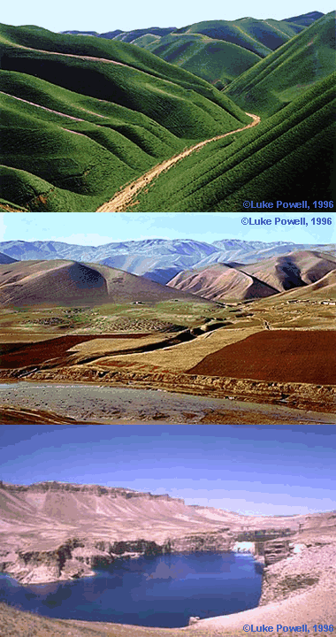
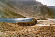
The barren Band-i-Amir region offers deep blue lakes set amid treeless desert and hills at
an elevation of 9,800 ft/3,000 m. Up to two days could be spent exploring the area, probably in a sturdy 4-wheel-drive vehicle.
200 km west of Kabul.
Jalalabad:-:The capital of Nangarhar Province was an attractive winter resort, with many cypress trees and flowering shrubs. This ancient walled town of 58,000 guards the western end of the Khyber Pass. A playground for the rich and famous of the ancient world, Jalalabad continued to serve as a resort for the wealthy during the winter - Afghanistan's last king had a palace there. More recently, the city was the site of fierce battles and drawn-out sieges in the Soviet war. 113 km east of Kabul. Ghazni:-:
It lies beside the Ghazni River on a high plateau at an elevation of 2,225 meter. Afghanistan's only remaining walled town, it is dominated by a 45 metre high citadel built in the 13th century. Around the nearby village of Rowzeh-e Sultan, on the old road to Kabul, 130 km northeast), are the ruins of ancient Ghazna, including two 43-metre towers and the tomb of Mahmud of Ghazna (971-1030), the most powerful emir (or sultan) of the Ghaznavid dynasty. Capital of Ghazni province with a population of 35,900 on the Lora River. Located on the Kabul-Kandahar trade route, Ghazni is a market for sheep, wool, camel hair cloth, corn, and fruit. The famed Afghan sheepskin coats are made in the city. Bagram:-:
Bagram Airbase is located in the Parvan Province approximately 11 kilometers (7 miles) southeast of the city of Charikar and 47 Kilometers (27 miles) north of Kabul. The Airfield is served by a 10,000 foot runway built in 1976 capable of serving large cargo and bomber aircraft. As of late January 2002, there were somewhat over 4,000 US troops in Afghanistan, of which about 3,000 were at Kandahar airport, and about 500 were stationed at the air base in Bagram. As of mid-March 2002 American heavy construction equipment was employed at Bagram erecting steel frames for new shelters and building earth-filled security barriers. American C-17 transport aircraft were arriving every few hours, and as many as 50 helicopters, including CH-47 Chinooks, AH-64 Apaches, AH-1 Cobras, and UH-60 Black Hawks were visible on the taxiways. As of late June 2002, Italian Air Force troops, assisted by Polish and U.S. military engineers, had been working together to repair the runway by fixing holes there. Baghlan:-:
city, northeastern Afghanistan, near the Qonduz River, at an elevation of 1,650 feet (500 m). Baghlan is the centre of beet-sugar production and has a sugar refinery. Cotton textiles are also manufactured. The city's industrial development has led to rapid population growth. Recently built major highways link Baghlan with Kabul, the nation's capital, 130 miles (210 km) south, and with other commercial, industrial, and administrative centres of Afghanistan. About 20 miles (32 km) southwest of Baghlan is Ateshkadeh-ye Sorkh Kowtal, site of the ruins of a Zoroastrian fire temple, believed to have been built in the 1st century AD by the Kushan emperor Kaniska I. The population of Baghlan is predominantly Tadzhik. Pop. (1982 est.) 41,240. Kunduz:-:
Kunduz is a city in Afghanistan; the name has also sometimes been rendered as Kûnduz, Qonduz,
Qondûz, Konduz, Kondûz, Kondoz, or Qhunduz. The city was anciently known as Drapsaka, and was a place of importance visited
by Alexander the Great. Kunduz is located at 36.73°N, 68.86°E, at an elevation of 397 meters above sea level. In the 1979
census (most recent) Kunduz had a population of 53,251 people. In 2001 it was estimated to have about 60,000 people.
Kunduz is also a province around the city, with an area of 7,827 km square, and a population of about 583,000. Faizabad:-:
(both : fi´zebad, fizäbäd´) or Feyzabad , city (1992 est. pop. 9,098), capital of Badakhshan
prov., NE Afghanistan, on the Kokcha River. The chief commercial and administrative center of NE Afghanistan and the Pamir
region, Faizabad also has rice and flour mills. Most of its people are Tajiks. In winter the city is sometimes isolated by
deep snow. In 1979 it was a focus of Afghan guerrillas attempting to repel the Soviet invasion. Faizabad was taken by Soviet
forces in 1980 and became a major Soviet garrison town.
Maimana:-:
(mi´mene) , city (1979 pop. 38,250), N Afghanistan. A walled city inhabited mainly by Uzbeks,
Maimana is a district administrative center and a market for leather goods, silk, wheat, and barley.
Farah:-:
Town (1985 est. pop. 21,000), capital of Farah and Chakhansur prov., W Afghanistan, on the
Farah River. Surrounded by a solid earth rampart, it is strategically located at the river crossing that controls the road
from Herat to the Seistan region and the Indian subcontinent. The town also lies on the Herat-Kandahar trade route and is
a market for the products of the surrounding agricultural region. Farah is inhabited mostly by Tajiks. Generally identified
with ancient Phrada, it flourished until Mongols destroyed it in 1221. It revived but suffered renewed devastation by the
Persian ruler Nadir Shah in 1737. Farah was the scene of fierce fighting during the early days of the Afghanistan War.
Zaranj:-:
It is the capital of Nimroz province in southern Afghanistan, and is considered the most remote
city in Afghanistan. The weather is hot-dry and the land is mostly sandy. Its neighboring provinces are Helmand from east
and Farah from north, and it has got international borders with Islamic Republic of Pakistan from south and on the west with
Islamic Republic of Iran. Zaranj is the capital of Afghanistan’s Baluch population, whom are busy in business of goods
between Iran and Afghanistan. This province provided the only pocket of resistance against Taliban during the 1996-2001 period.
Chachgaran:-:
Ghowr province (sometimes spelled Ghor) is one of the thirty-four provinces of Afghanistan.
It is in the west of the country. Its capital is Chaghcharan.
American adventurer Josiah Harlan won the title Prince of Ghor for himself and his descendants in perpetuity, in exchange for military aid during local factional fighting. Scott Reiniger, star of cult classic horror film Dawn of the Dead, is Harlan's great-great-great-grandson, and thus (as of 2004) heir to the title Prince of Ghor. Qalat:-:
Qalat is capital of Zabul province in southern Afghanistan. Its’ neighboring provinces
are Paktia, Ghazni, Uruzgan, Kandahar, and in the south it has international border with Islamic Republic of Pakistan. The
city of Qalat is located on Kabul-Kandahar high-way. Hundred percent population of this city are Pashtoons. According to 1979
database the population of this city was reaching fifty thousand.
Gardez:-:
Gardez is the capital of Paktia province, Afghanistan. The city is not far from the Tora Bora.
Gardez is west of Khost.
|
|
|||||||||||||||||||||||||||||||||
|
[ Go to Top ]
. 
|
|||||||||||||||||||||||||||||||||||


